
This is a walk I was very excited about, the Grampians is the pinnacle of bushwalking in Victoria with rugged mountain peaks and breathtaking views, it’s the go to destination for Victorians wanting an adventure, but honestly, I was disappointed.
The mountains are rugged, the views are breathtaking, but the crowds were…overwhelming. I knew going in that it could be busy, but it’s late Autumn and getting cold, I thought perhaps I’d miss all the people. I was wrong. Look, it’s my fault for picking what’s probably the most popular walk in the Grampians, passing Venus Baths, the Grand Canyon and up to the Pinnacle. If peace and solitude is what you’re after, this is not the walk for you. However, if you’re after a challenge, don’t mind some company along the way, and want minimal organisation, then you’ll love it.
Day 1
- Distance:
- 11.5km
- Duration:
- 5h
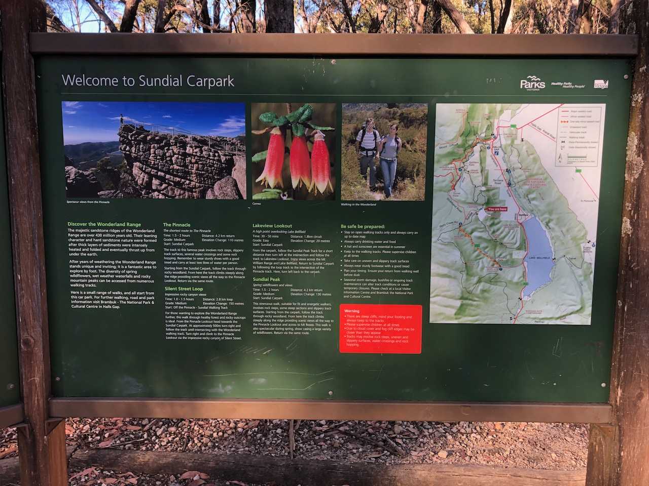
This overnight walk is an out and back that sets off from and returns to Halls Gap. There’s a variation to do a car shuffle or get a transfer from Borough Huts Campground, making it a one way trip, but the out and back requires the least coordination.
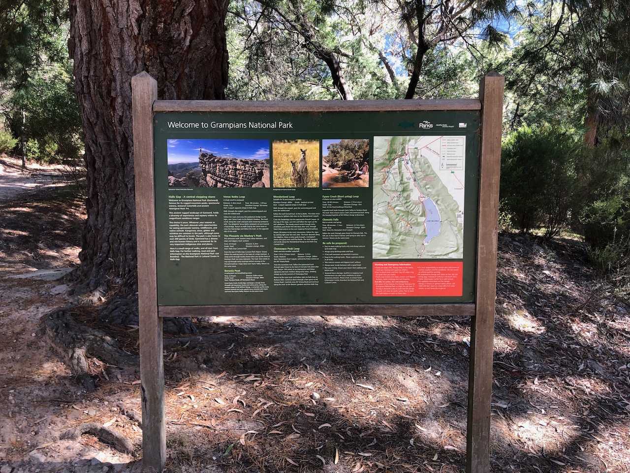
There’s plenty of parking at Halls Gap, I parked on Heath St behind the information centre, but it seems there’s ample parking out the front of the caravan park. Parking here may save you trudging with your pack through the main street if you feel self conscious about that.
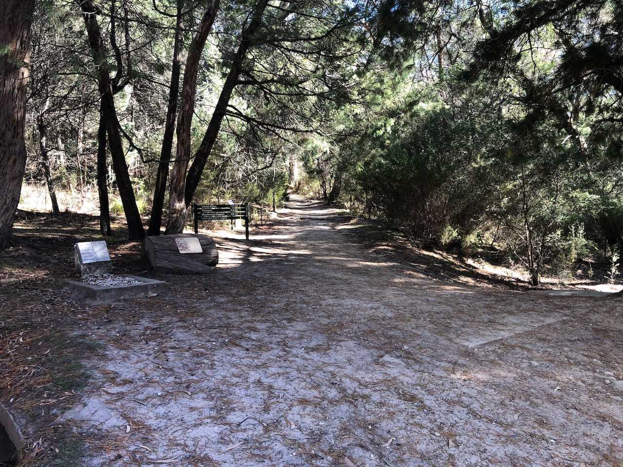
The trail starts in the northwestern corner of the Halls Gap Caravan Park, follow the signs (and crowds) to Venus Baths and then onward towards Moonlight carpark. At this point I was already regretting every non-essential thing in my pack and mentally listing all the things I wished I hadn’t brought, because my pack was heavy and the trail is consistently uphill. I consider myself reasonably fit (my wife may disagree) but I was surprised how hard it was.
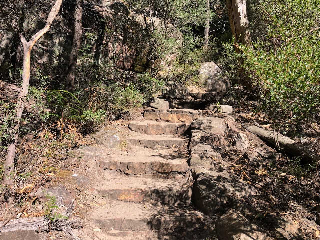
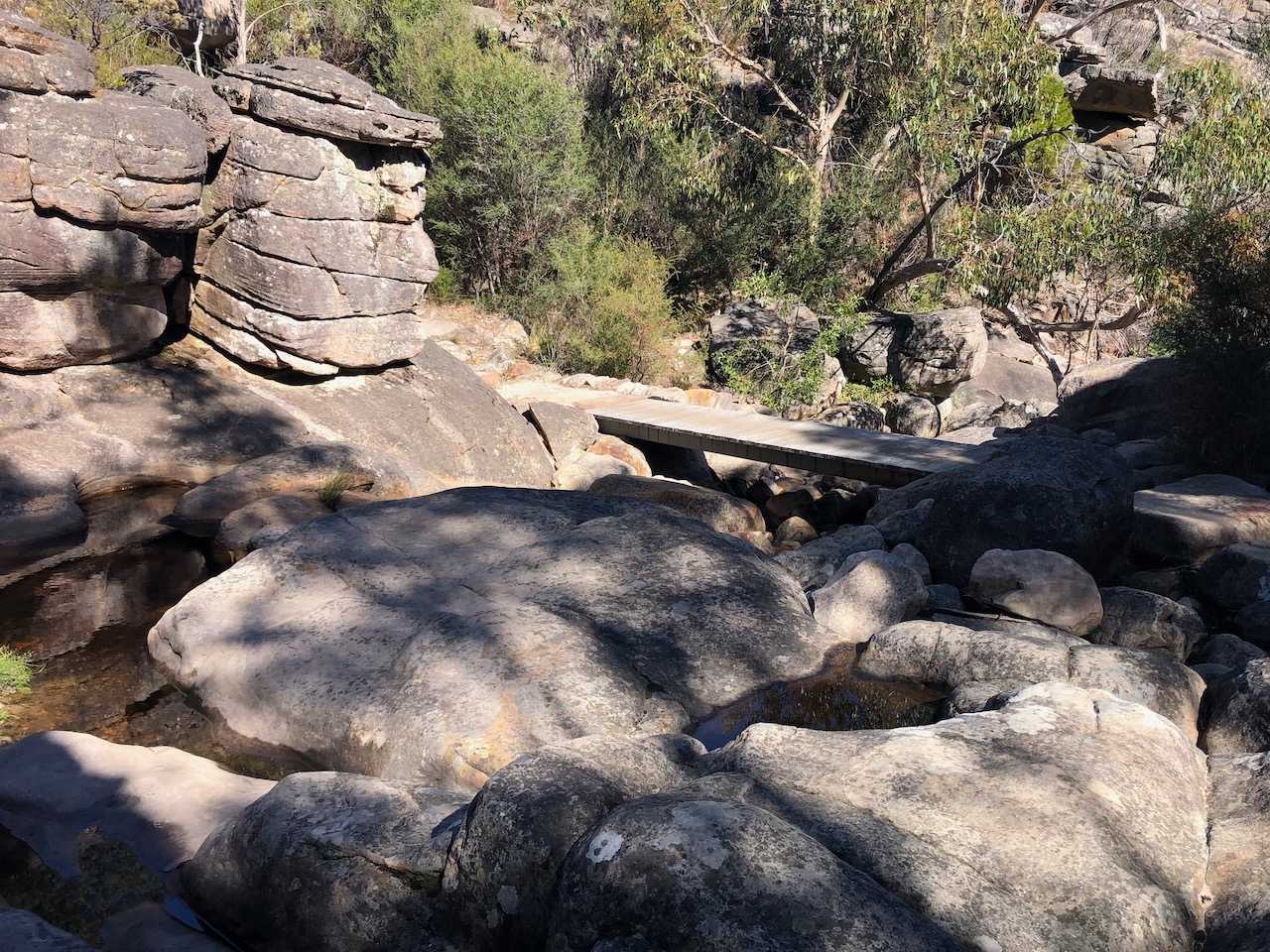
After clambering over a rocky ravine that crosses Stony Creek (it’s a very apt name) you’ll come to a fork when you can head left up the Grand Canyon, or if you prefer, or if the Grand Canyon pass is closed as in my experience, you can head right and take the longer way around. Either way you should do some stretching now, because you’re in for a gruelling climb the Pinncale.
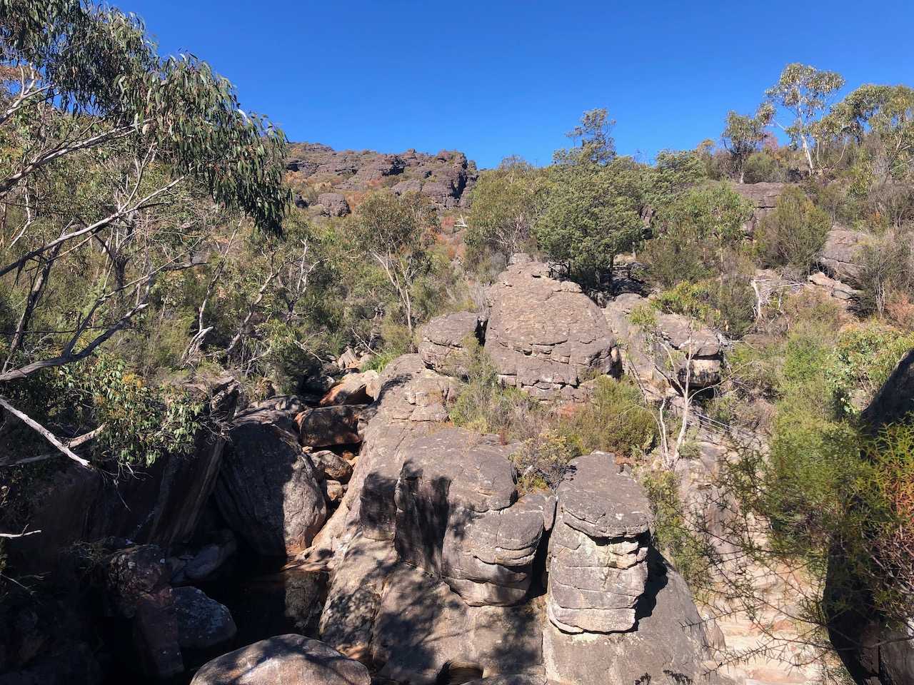
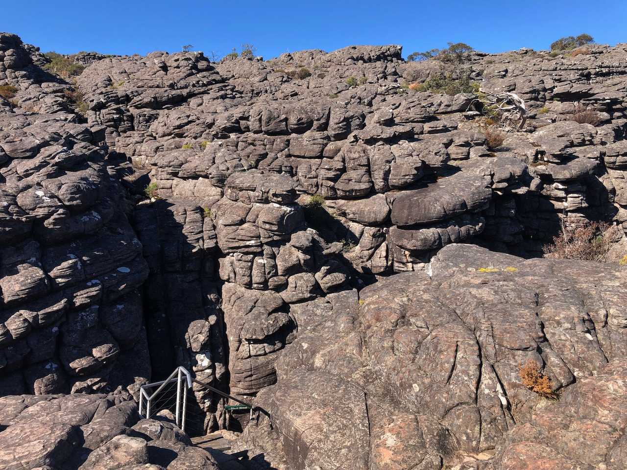
Most of the track is over rocky outcrops, passing the Cool Chamber and Echo Chamber caves, keep and eye for the little orange triangles pointing your way. Eventually you’ll make it to the very narrow corridor of Silent Street, where you’ll need to weave your way between people and possibly need to remove your pack to fit through, but take relief that you’re almost at the top now.
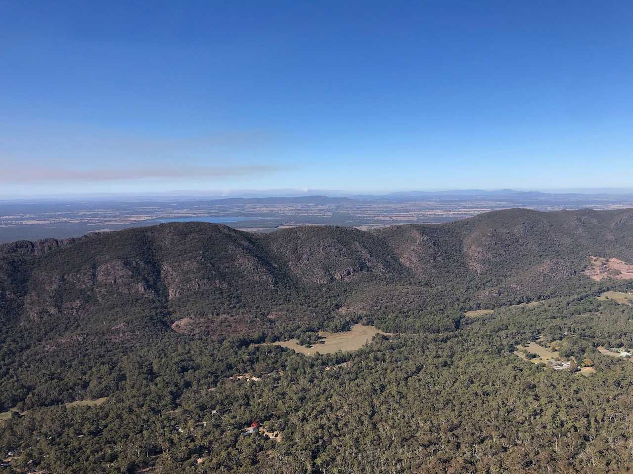
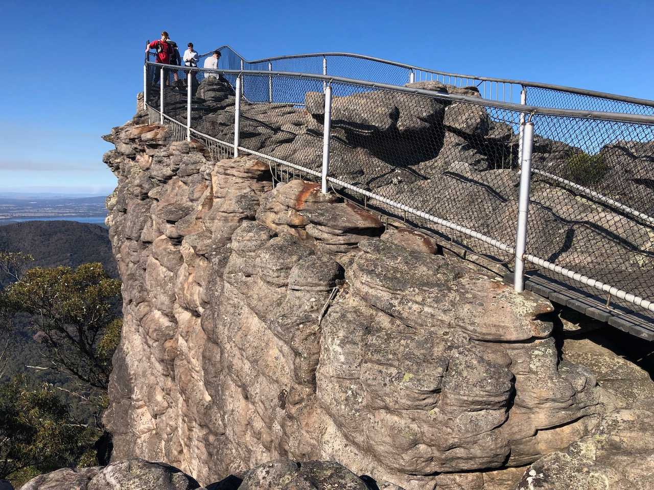
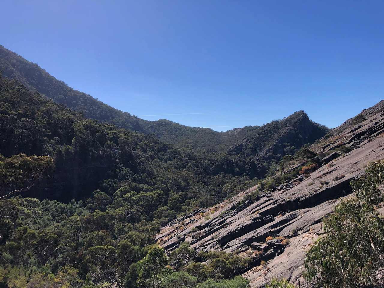
You know you’re at the Pinnacle when the world opens up and you can start to see for miles around. Take in these spectacular views and be comforted that you’re over half the way there, and definitely over the hardest part.
When you’re ready to move on, look for the trail marker to the south that leads towards Sundial carpark. You’ll need to pick your way down some rocks before the trail finally levels out. As you bypass Sundial carpark you’ll have an opportunity for a short detour to Lakeview Lookout, but before this is an unmarked rocky outcrop which boasts amazing views of the whole valley. If you’re brave enough to step across to the large boulder, you can sit and enjoy the whole scene, I assure you it’s worth it.
The remainder of the days walk consists of more gentle uphill and downhill sections leading finally into Bugiga campground. Bugiga sits on the western side of the range, giving you lovely views of the afternoon sun.
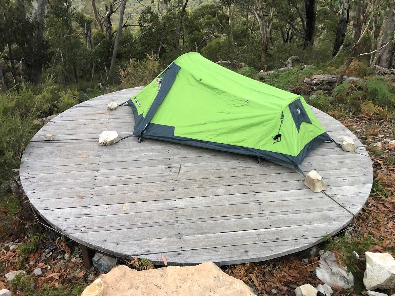
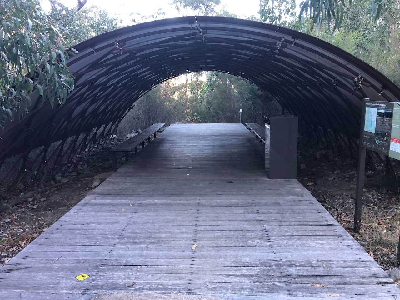
Camping at Bugiga requires a permit which cost around $60 when I visited, but for that you get dual drop toilets, rainwater taps, a covered communal cooking area, wooden walking platforms and individual tent pads to lessen your impact on the environment. The slats of the tent pads are pretty close together so you may not be able to anchor tent pegs on it, instead there’s a wire running around the outside that you can tie cords to to hold the tent down.
Day 2
- Distance:
- 8.37km
- Duration:
- 3h 14m
The sun is rising, you’ve had breakfast, rolled up your tent and repacked your bag, it’s time to head home. If you’ve organised transport from Borough Huts Campground, then it’s a 13.8km walk that way, or if you’e heading straight back to Halls Gap you can return via the same route, or take a shorter trail via the Halls Gap to Pinnacle Track. I was eager to make it back to Melbourne before peak hour so took the latter.
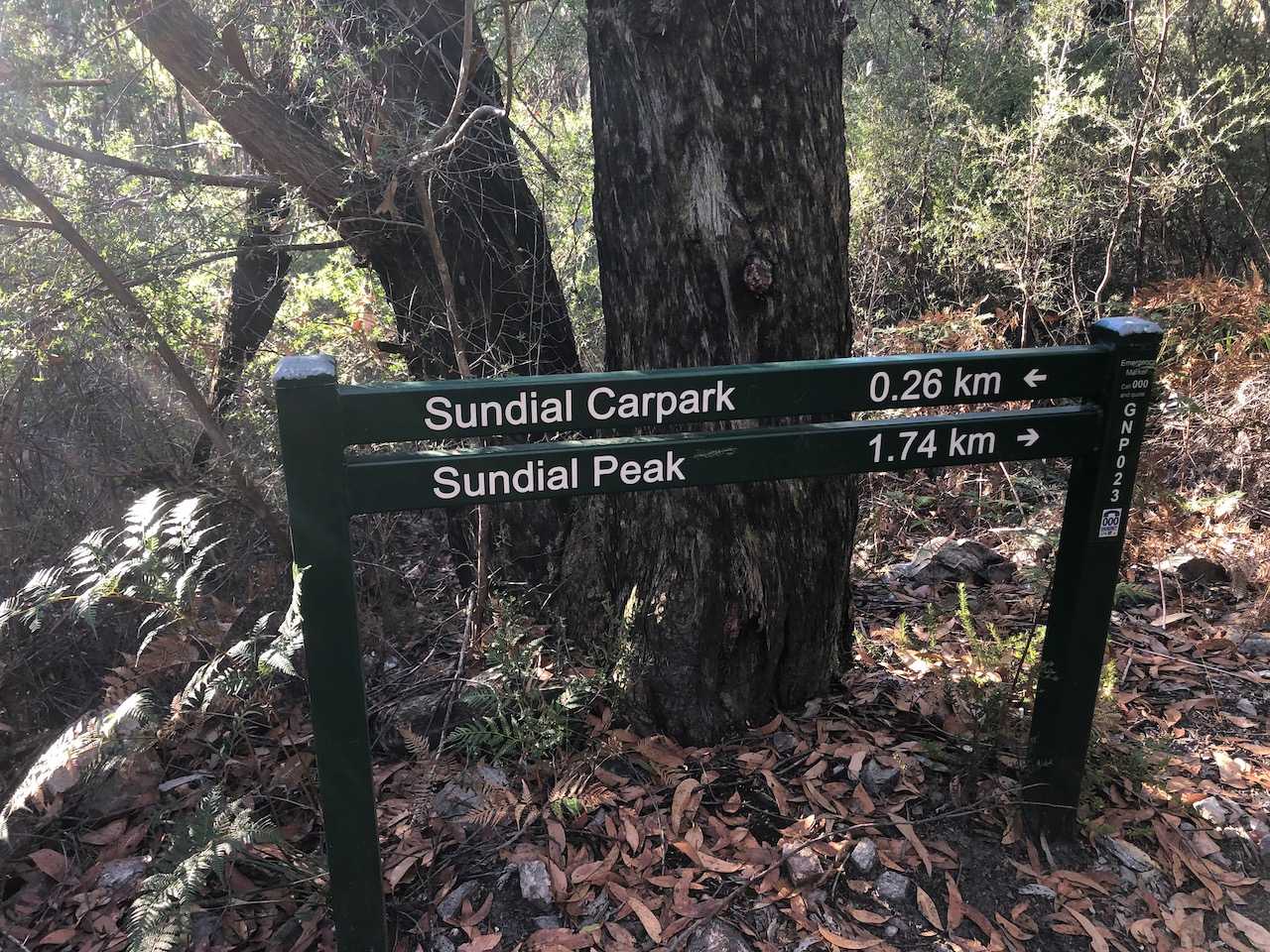
Feeling refreshed from a sleep, the return journey was much more enjoyable. Starting with slight uphill around the mountain it gently winds till you meet back with the Sundial Track. If you have time to spare, a 1.74km excursion to Sundial Peak would be a worthwhile exercise, but if you’re watching the clock then head straight for Sundial Carpark and back to the Pinnacle. In this early morning hour you may be fortunate to get these stunning views to yourself.
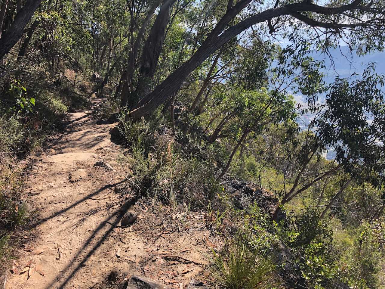
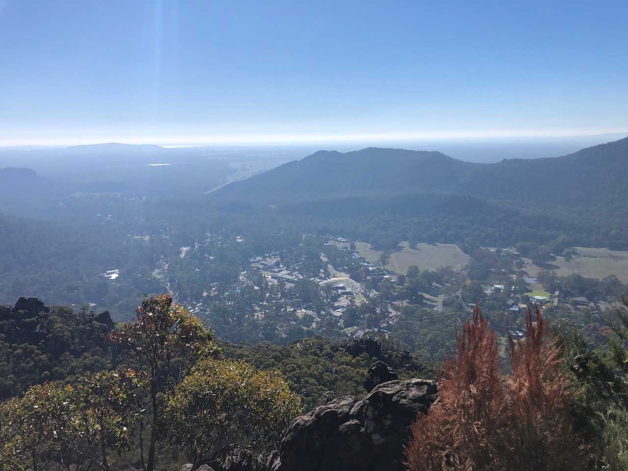
Heading back towards Wonderland Carpark you’ll quickly come see the Halls Gap Trail fork off eastward. Follow this trail across a few more boulders before it smooths out to hard compacted dirt path for most of the remainder of the journey. Feel yourself skip along as you enjoy the constant downhill grade, broken up by a few metal steps, and nod politely with sympathy to those ascending uphill. Looking east you’ll get plenty of opportunities to see Halls Gap slowly coming closer.
Resources
Grampians Halls Gap to Bugiga Hiker Camp - Day 1.gpx
Grampians Halls Gap to Bugiga Hiker Camp - Day 2.gpx
Halls Gap to Bugiga Map 25k